Denver Weather: Gusty Storms Today, Cooler with More Rain Chances Friday and Saturday

In brief: Scattered storms and gusty winds hit Denver Thursday, with more widespread showers and cooler temperatures expected Friday and Saturday across the Front Range.

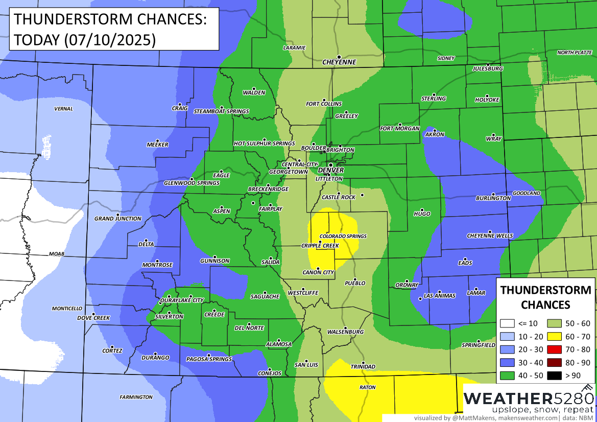
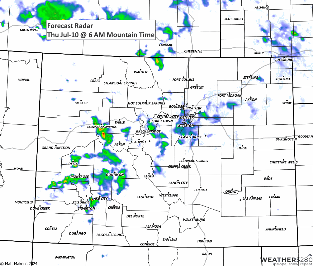
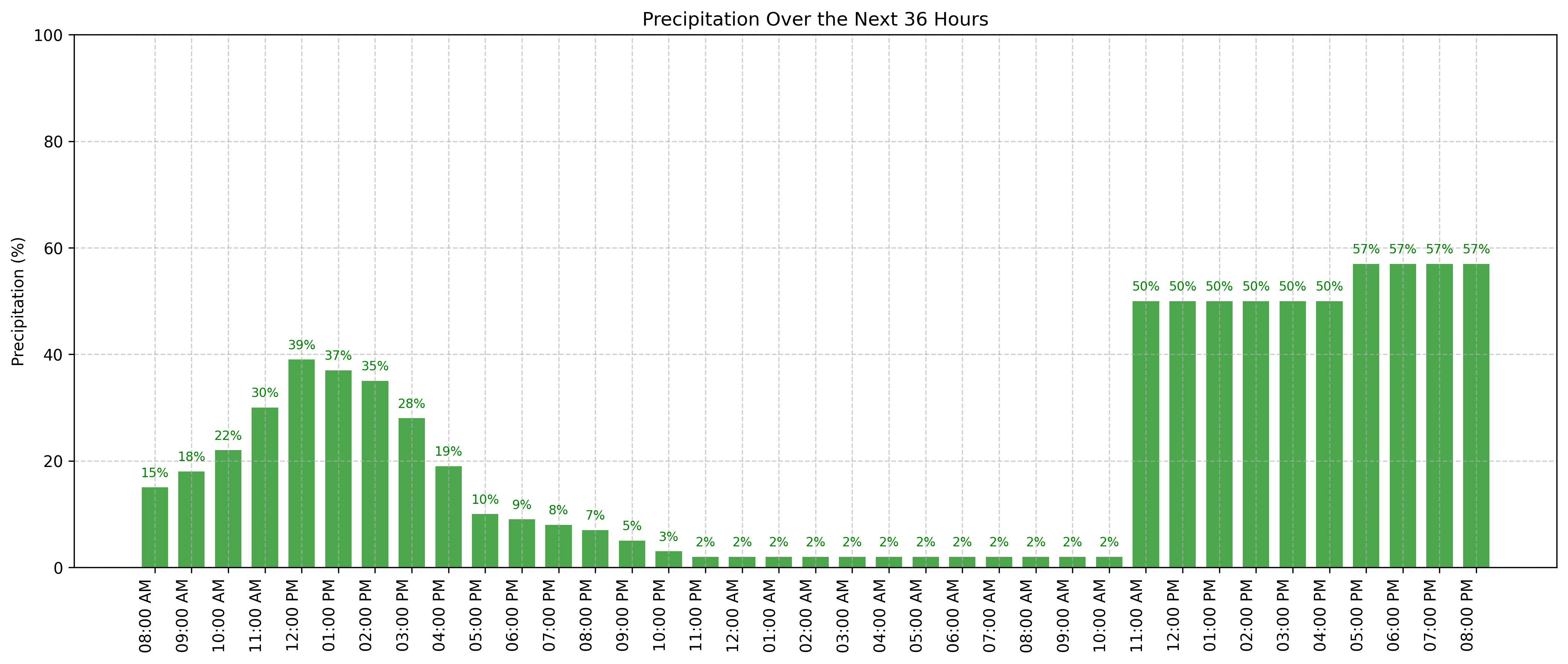
In detail: Thursday is off to a warm start, and we may see a brief break in the cloud cover this morning. However, as we head into the late morning and early afternoon, expect scattered showers and thunderstorms to develop—especially over the mountains and along the I-25 corridor.
The biggest concern today is strong outflow winds, with most areas likely to see gusts between 30 and 50 mph. A few stronger cells could produce gusts as high as 65 mph. Rainfall may be briefly moderate to heavy, but totals will generally stay under a quarter inch. Most storms will taper off early in the evening.

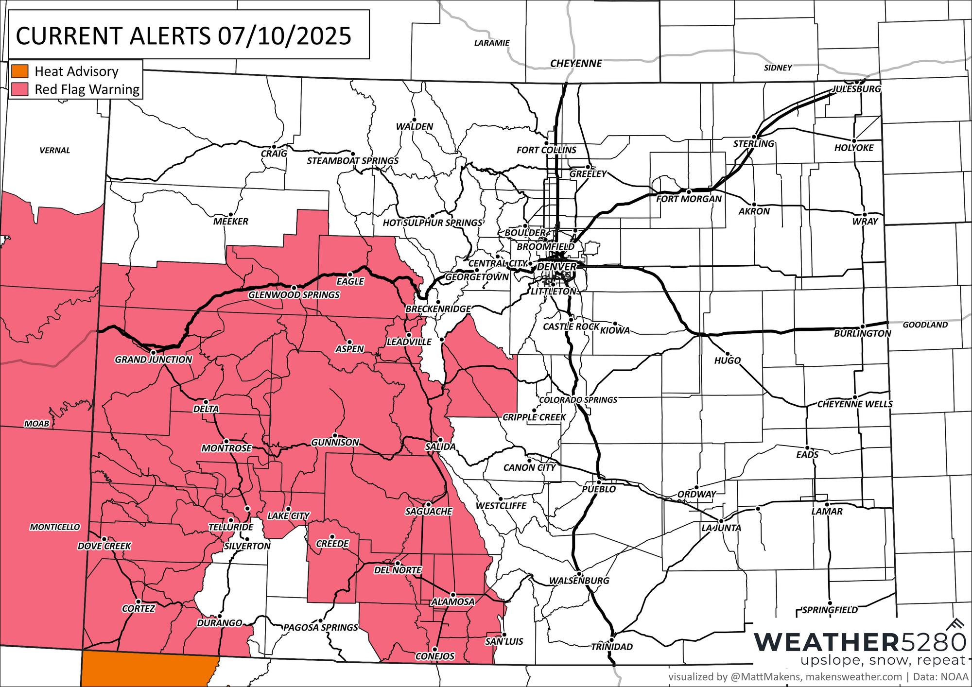
Critical fire weather conditions are in place today for much of western/southwestern Colorado due to the gusty winds and dry conditions.
Looking ahead to Friday and Saturday, we expect a better chance for late-day showers and thunderstorms. Highs will drop into the 80s, and storm coverage should be more widespread, especially Friday afternoon through the evening. Saturday follows a similar pattern, with afternoon storms possible once again.
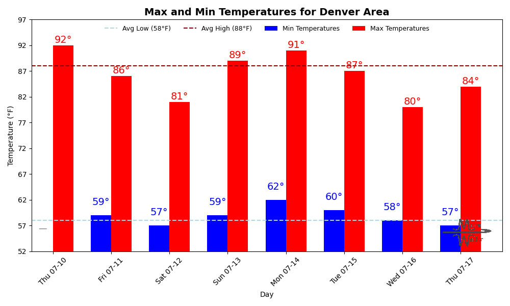
Sunday looks drier and hotter, with sunshine and highs back in the low 90s. Plan for unsettled weather the next couple of days, especially in the afternoons, and stay alert for strong wind gusts with any storm that rolls through.