
Hot Tuesday becomes monsoon surge Wednesday

Happy Tuesday all! First off, let's show you some intense video from Monday afternoon in Franktown –
https://x.com/i/status/1944884229008998531
That's video Douglas County Sheriff posted on social media, after a possible landspout tornado caused damage in the town.
https://x.com/NWSBoulder/status/1944859465775239587
The storm managed to get a Special Weather Statement with a landspout tag. We're expecting to get some official word from the NWS on this at some point.
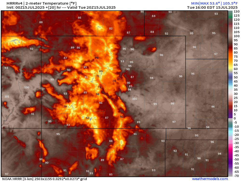
We may see a couple rounds of gusty showers on Tuesday, but the the heat should stave off storm potential for the most part. Below are potential high temps according to HRRR data. You can see plenty of mid-90s for the Denver Metro with 90s and temps near 100 for much of southeast Colorado.
We're on tap for a pretty significant pattern flip as we go into the end of the week. A lingering Baja low, plus a bulging southeast ridge, all in combination with a passing trough should all combine to bring widespread monsoonal storms on Wednesday. This will also yield another nice cooldown for us!
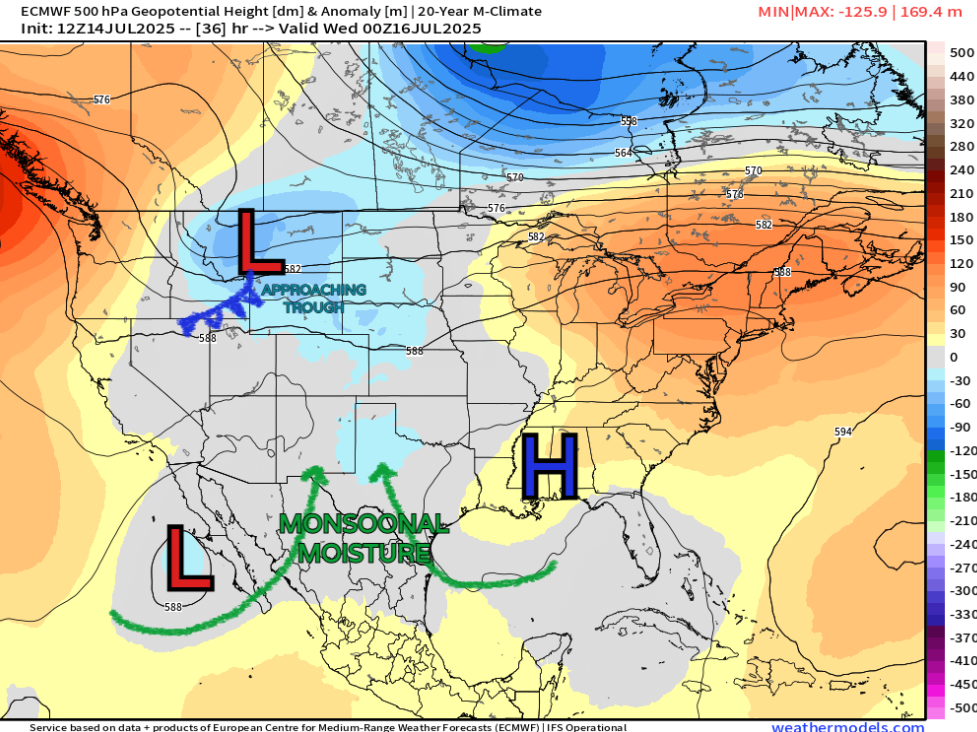
A few storms on Wednesday could end up severe, but mostly it would be beneficial rain for the higher terrain and east along the Front Range. This pattern looks to have some staying power as well... much of the mid-to-long range data indicates prolonged western US troughing, and that southeast ridge supporting moisture transport into Colorado.
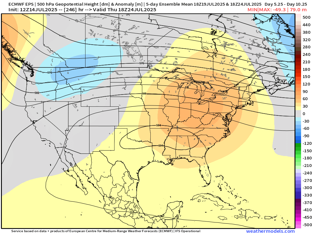
This also means we could see a few more of these of these cooldowns between now and the end of the month! No complaining here!
This is your typical summer pattern, so there's not a whole lot else to go over. We'll likely work on another update for you for Wednesday to dig into a bit more detail on storm trends.
Have a good one folks!
Luke