
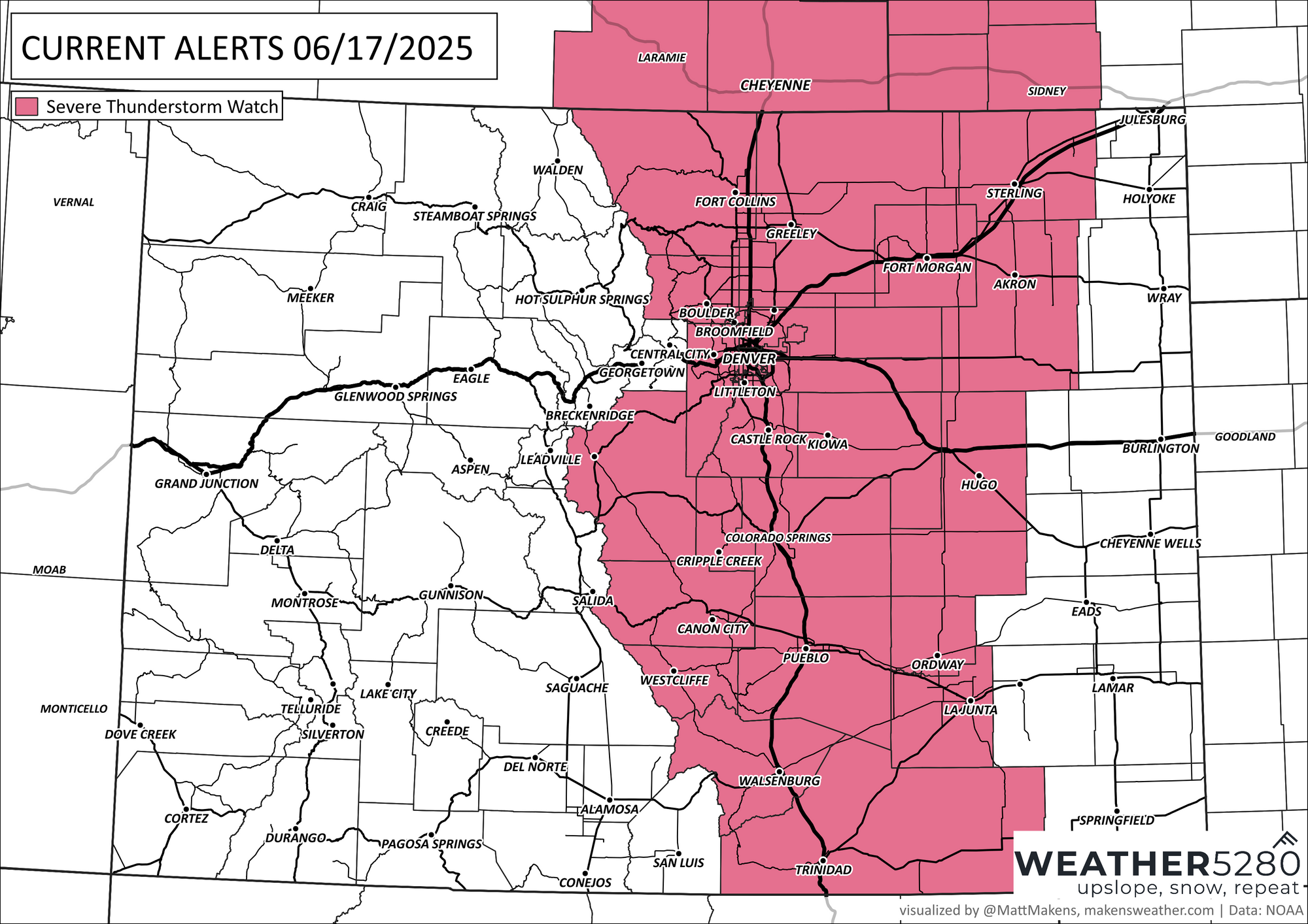
Severe Weather: Severe thunderstorm watch issued, covers entire Front Range

In brief: Watch for severe storms with hail and wind this afternoon along the I-25 corridor before heat builds later this week.
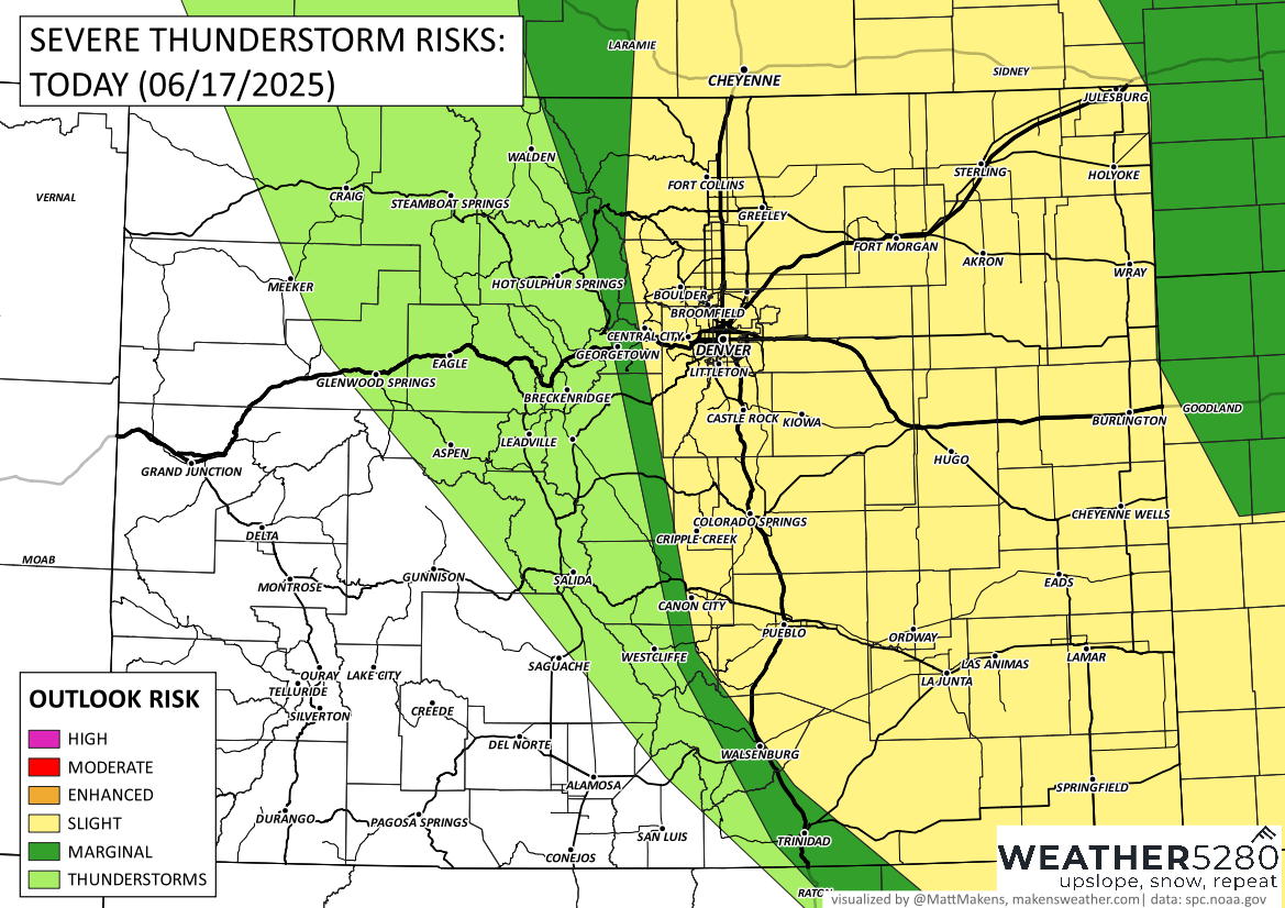
In detail: After a rare round of overnight thunderstorms, including some severe storms, we’re in for another active afternoon across eastern Colorado. A Severe Thunderstorm Watch is already in effect through 5 PM, covering much of the I-25 corridor, including Denver, Boulder, Fort Collins, and Colorado Springs.
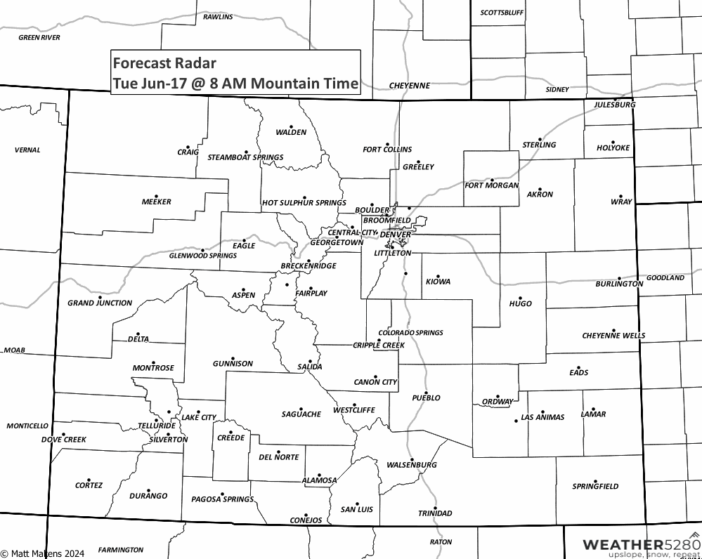
Today’s storms could begin as early as noon, especially from Denver northward. They’ll likely become more widespread through the early afternoon before quickly pushing east by the evening commute. Expect the most intense activity to be over by 6 PM. The main threats will be large hail and damaging wind gusts, with wind being the greater concern as storms organize into line segments east of I-25. Does your office building have a garage? If not, maybe go sit in a carwash...
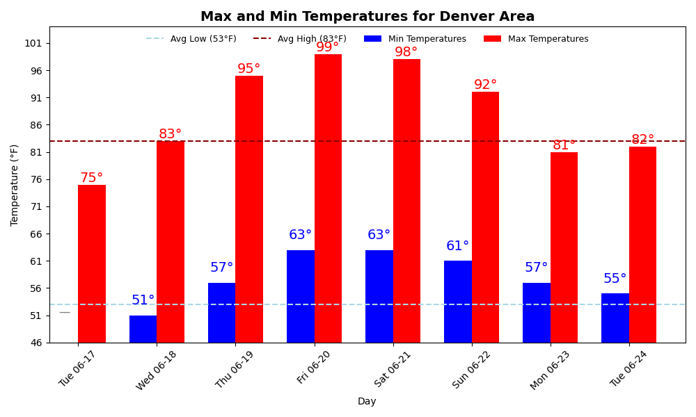
Rain is likely for most of the area, and we’ll feel noticeably cooler today—a break from the recent heat. Highs will hover in the 70s for many spots.
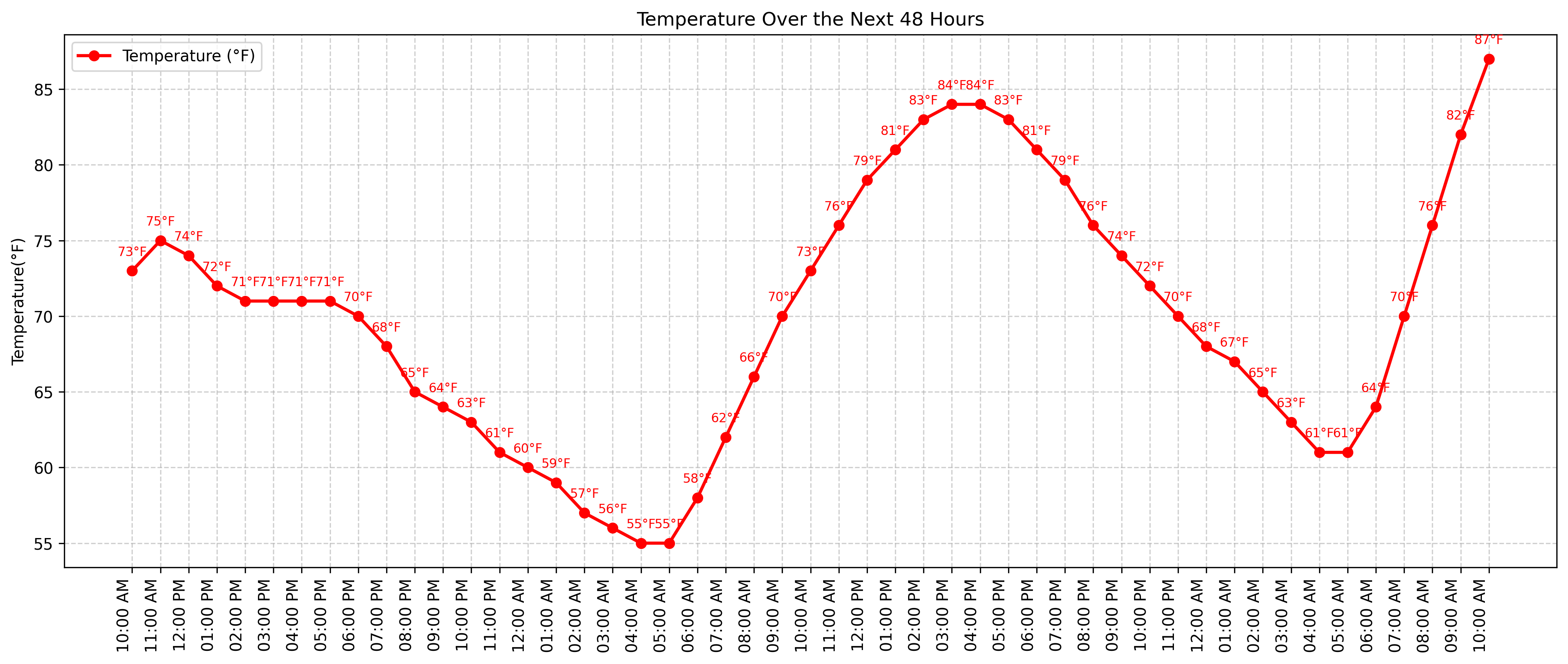
Looking ahead, that cooldown won’t last. Starting Wednesday, temperatures begin to climb again, with record heat possible by Friday. Highs could soar into the upper 90s to near 100 degrees, especially across lower elevations. The heat could also bring critical fire weather conditions later in the week as dry air and gusty winds return.
We’ll keep you posted on how today’s storms develop and have more details on the heat wave as we get closer.